Amsterdam School of International Business

The IMAGE Project: Researching the city: Mapping Imaginaries
During the last two years we have been working on the project IMAGE: Researching the City Mapping Imaginaries in cooperation with a broad array of partners in our cities. The project is a follow up of a longer engagement and cooperation for a better understanding of our cities. The project has been made possible thanks to the support of the European Strategic Partnership programme Erasmus+.
On this page:
The IMAGE Project
The trigger for this partnership was mainly born from the increasing awareness that our look at cities' reputations (and at the reputations of areas within cities) could use more diverse enlargement and lighting. Without denying the relevance of by now referential iconic places, there is a need to go beyond the already established and towards a new positioning for cities that captures a broader and more substantiated city map: a map that contributes to seeing beyond the ‘obvious’, towards the less known.
The matter is urgent. Despite city campaigns, which insist on spreading residents and visitors through our cities, cities tend to concentrate attention, and investments in areas that are already considered referential. But the crux is then, why not extend our view on how reputation and attention is built, and really contribute to a more informed city mapping including a larger diversity of areas and centres of interest? Or as some creative entrepreneurs have put it: Instead of everybody aiming to be in a place that is already successful, wouldn't it be better to find new ways of making more places successful? After all, it is in the so-called ‘peripheral’ areas that many of our institutions have found a place to build venues and campuses. There are many reasons for these developments, however, it is important to remember the explicit desire of our institutions to contribute to a more varied and prosperous city. Being students, faculty and partners in cities means being agents in these processes as well.
Our districts and neighbourhoods in the partners cities:
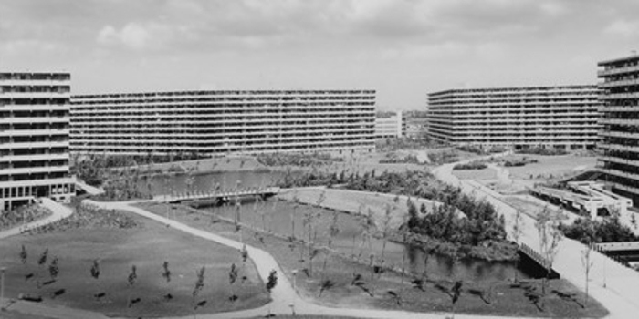
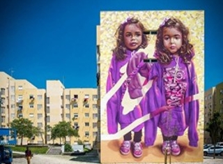
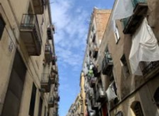
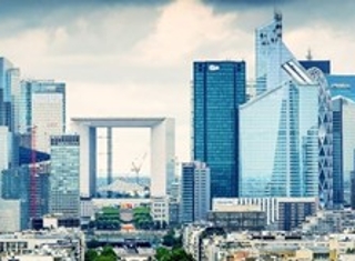
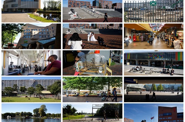
Amsterdam -Zuidoost-; Barcelona -el Raval-; Lisbon -Carnide-; Paris -La Defènse-; Vienna -St. Marx-;
Mapping Imaginaries as a Method
Energized by such thoughts, one starts to realize the importance of understanding places all over the world in their capacity to absorb and concentrate time and space. One also starts to question longstanding concepts such as centre and periphery and discovers that very often these concepts are matters of perception that at the same time truly influence peoples’ lives and places’ prosperities. Guided by connoisseurs, walking, observing, checking in archives, exploring on the internet we experienced that even apparently uninteresting ‘peripheral’ places in our cities can in fact condense an array of all kinds of ideas and imaginations, including unfinished stories and broken dreams (that can at once be revitalized with new energies).
This is when the concept of Imaginaries arises in its full potential. Born in the field of the so-called sciences of ideas, imaginaries have become a way of expressing how humans have given meaning to their lives in places, shaping urban landscapes and collective lives, developing arts, starting business, emerging technology, creating, combining and also mistaking all at the same time. Mapping imaginaries is about gathering this knowledge and also about making the intercity and universal connections between places visible. A starting point here is that places can be understood as performative spaces. Places can be defined as a set of relations that not only (or not necessarily) gather what is happening at a specific site at a specific time, but rather ‘fold and pleat’ in space and time into complex configurations. Moreover, the mapping should not avoid portraying the controversial or the polemic. One should also remember that places with a negative image (of being dangerous, for example), can evolve and become indispensable cultural references.
We then also see why it might be true that ideas and imaginations never totally die. Interesting new trends and flows show how imaginations from the past relate with the present and become an envisaged projection of the future. And all those dreams and imaginations, all the imaginaries are not at all limited to one specific local place but are united in intercity and global flows as they respond to similar human needs.
The Role of Our Students
Thanks to the Erasmus + supported IMAGE project, our students have worked together with local partners, experts, and our teams of lecturers and researchers to explore and gain understanding of the areas around our campuses. The opportunity for them was to work in a European intercity cooperation as an attempt to combine and communicate our cities from within. The project has enabled our students to capture all those local places imaginaries in a more authentic and elaborated way while helping to remember the importance of vernacular languages as carriers of meanings. Connecting and understanding places from within can help us in short to shed new light in the always fascinating process of intercity cooperation and co-creation.
During the IMAGE Summit (8 November) an intercity representation of our students will introduce a mapping with specific references to the places that they have found especially interesting and that according to them can be linked in an intercity international flow of connectivity. These places have become what we call anchor points: they concentrate meanings, knowledge and experiences that were already there before we started our exploration but are re-energized thanks to the process of engaging and understanding.
The IMAGE Summit
Thanks to the openness and generosity of our local partners, we have been able to get to know an array of very interesting places and to work together on the mapping imaginaries project. We have now become an integral part of the areas’ environment and this enabled us to better visualize and connect our cities, with an up to date view, and to understand their current dynamic as what is often described in literature as polyphonic and polycentric
The IMAGE Summit is open to everyone. Working with us are citizens involved in different initiatives, cultural institutions, urban planners, architects, city positioners, members of the municipality, policy makers, advisors, a diversity of educational institutions, social workers, economists, media channels and representatives and so forth.